Dear supporters,
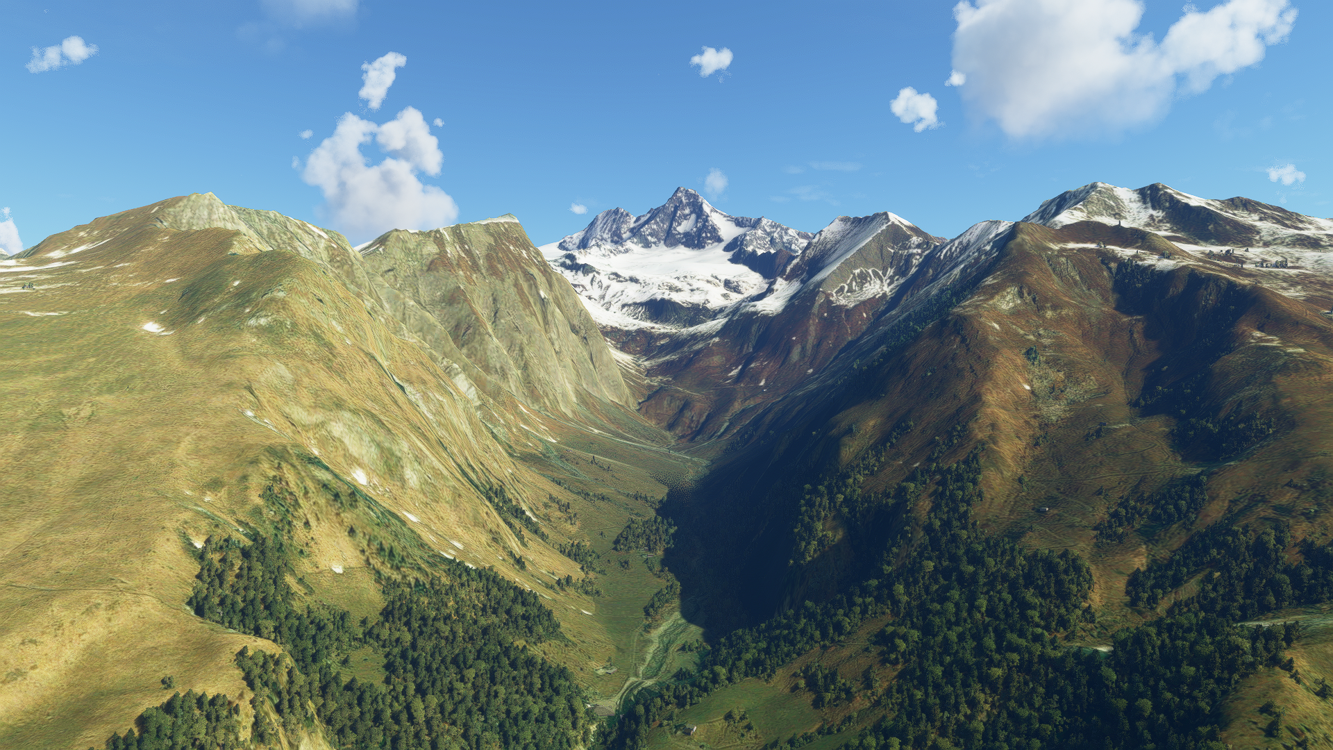
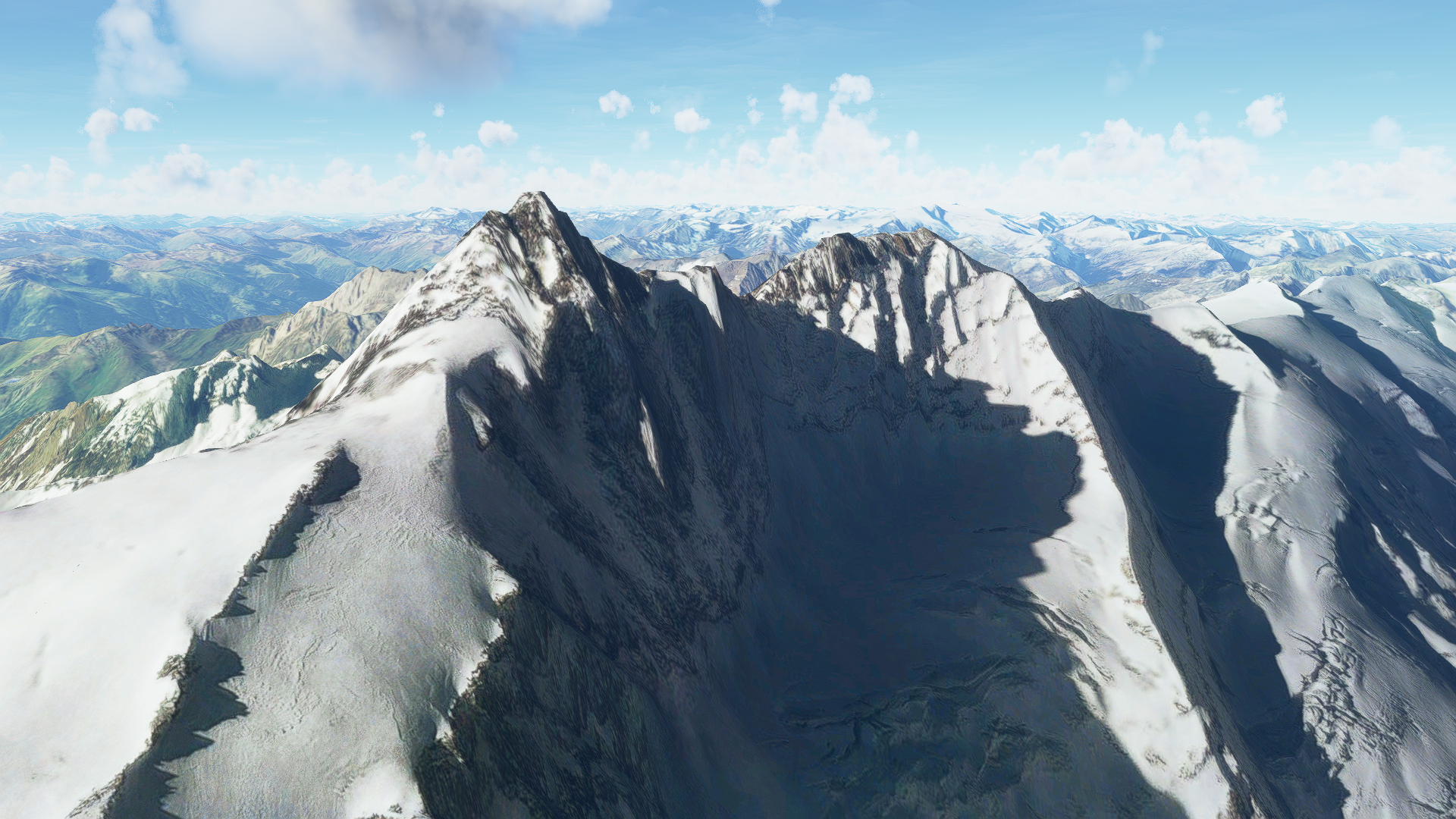
The last few days I have been playing with high definition height profiles for Austria. Microsofts base mesh has a datapoint every 50m, the custom profile I came across has points every 10m. This results in extremely detailed and livelike landscapes and reshapes the mountains according to reality. My goal is to give the Austrian alps the look they deserve inside MSFS. Hopefully everything works out as I imagine it to. For small areas the results are astonishing. As you can see in the provided screenshot, Großglockner (3798m) finally looks the way it's supposed to!
So this is something you can look forward to (If I manage to make it work for large areas)!
Thank for all your support and have a nice long weekend!
Best regards,
Troglodytus